A 7.0 magnitude earthquake hit Lushan County of Ya’an in southern China’s Sichuan Province at 08:02 Beijing Time on April 20, 2013. With a solid foundation of science and technology and a lofty sense of mission, the newly established CAS Institute of Remote Sensing and Digital Earth (RADI) rapidly started its emergency response system with remote sensing technology and built up a space-air-ground “sky-eye” system for disaster monitoring. Its remote sensing airplane took off to conduct disaster monitoring tasks only 108 minutes after the earthquake. Eight hours after the disaster, relevant data were available on the Internet, and an analysis report on the disaster was submitted to decision-makers within 24 hours. The institute provided urgently needed data and information for earthquake relief.
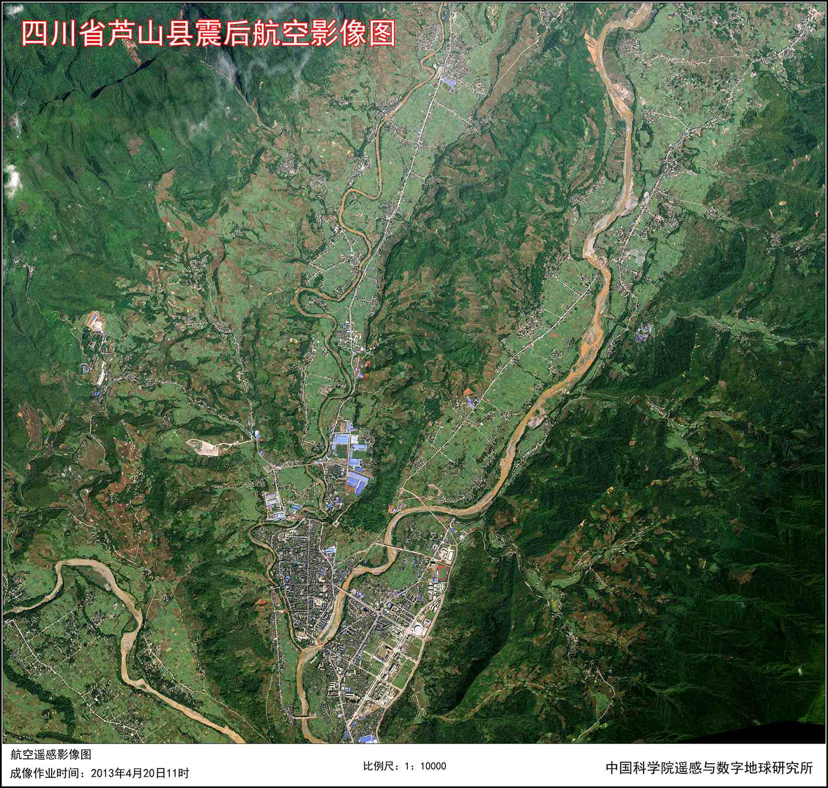 An aerial remote sensing image of Lushan County produced by RADI.
Initiating emergency response eight minutes after the quake
At 08:10 on April 20, only eight minutes after the earthquake, RADI staff conducting a remote sensing flight experiment to mark the fifth anniversary of the Wenchuan Earthquake in Sichuan reported the disaster. Accordingly, a leading group for earthquake monitoring and damage assessment with Prof. GUO Huadong as its leader was formed immediately. Under its coordination, taskforces were set up to handle such matters as satellite data acquisition and processing, aerial data acquisition and processing, disaster damage analysis and assessment, image production and data sharing, information reporting and liaisons, and logistics. At the same time, platforms for data exchange between different taskforces and for remote sensing data sharing were established.
The first airplane reached Ya’an 108 minutes after the earthquake
When the earthquake took place, RADI’s B-4101 remote sensing airplane was carrying out a task in Mianyang, Sichuan Province. Upon receiving the instruction from the institute, five researchers and crew members rapidly formulated an action plan to monitor the earthquake, including air route design, GPS base-station erection, and data downloading. At 09:50, 108 minutes after the earthquake, the plane took off from Mianyang Airport to Ya’an. It was the first flight of a remote sensing airplane hastening to the quake-hit area.
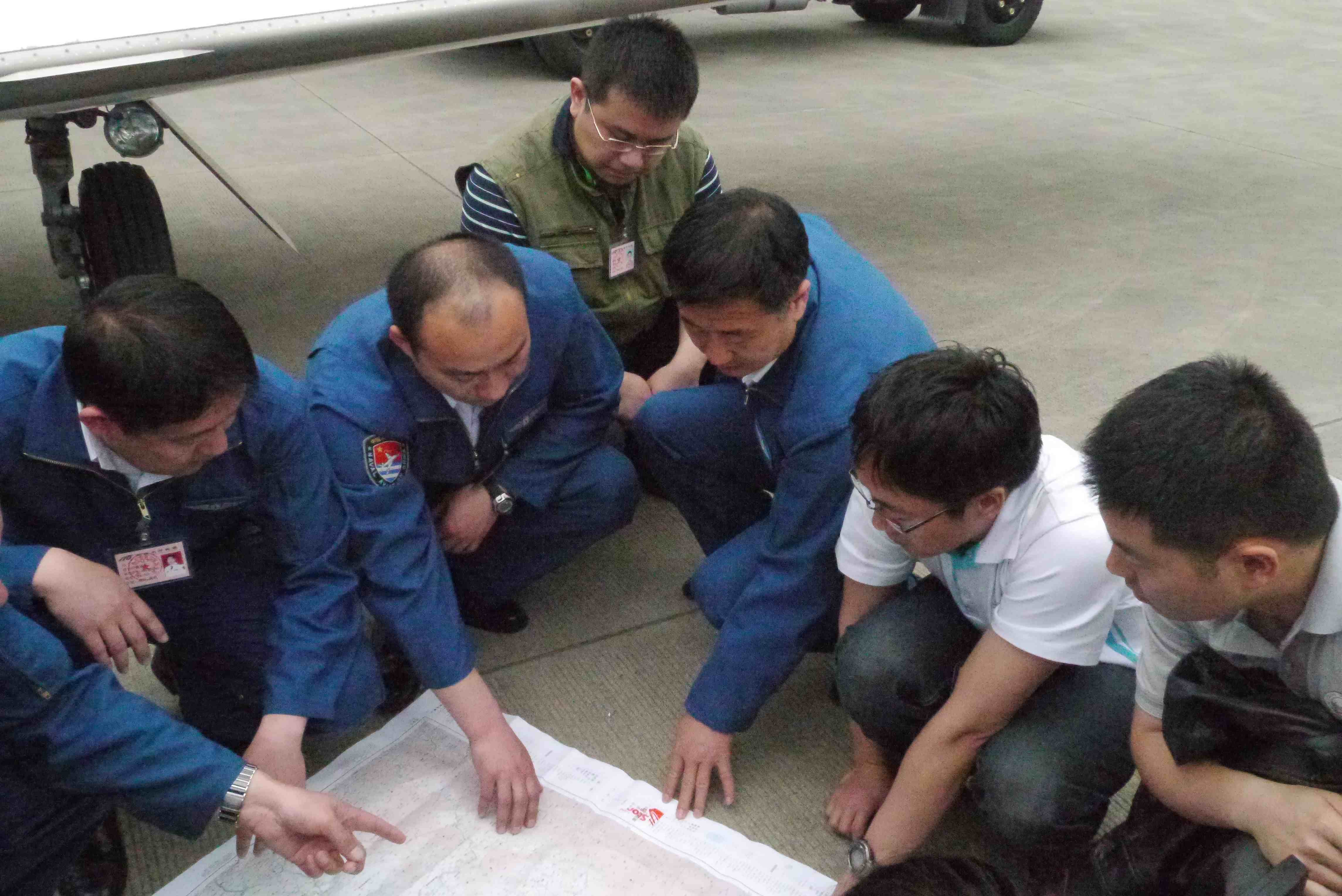 Crew members hold discussions on the flight plan.
The first sortie was completed at 13:40 with 256 GB of imagery data in 0.6-meter resolution. The three successive sorties after the first covered the whole quake-stricken area of 50,000 square kilometers and obtained a total of 503 GB of data. After receiving the first batch of airborne data, the seven-member taskforce for data processing worked continuously for about 40 hours with state-of-the art technology and transmitted the first “quick-look” data to the headquarters in Beijing at 16:00, providing important data support to the rescue operation.
Speedy distribution and sharing of remote sensing data after nine hours
At 16:57 on April 20, RADI shared its first batch of satellite data over the Internet, including pre-quake data about Ya’an from such satellites as SPOT-5, Landsat 5, and SPOT-4. At 08:00 am on April 21, the institute shared its airborne data. By 16:00 on April 27, there had been nearly 230,000 downloads at a total of 613 GB of data. About 5,700 GB of airborne imagery were sent in different channels to 35 organizations in 14 government departments, including the State Office for Emergency Management, China Earthquake Administration, Ministry of Civil Affairs, Ministry of Transport, Ministry of Land and Resources, General Staff Department of the PLA, Ministry of State Security, National Administration of Surveying, Mapping, and Geoinformation, China Meteorological Administration, Ministry of Water Resources, Ministry of Environmental Protection, Ministry of Education, and Ministry of Culture. Thanks to the rapid distribution system for massive aerial remote sensing data especially launched for disaster-hit areas, the data could be distributed to as many as 12 users concurrently, with an average distribution speed of 840 Mbps and a high speed of 4800Mbps. This was 14 times quicker than the distribution of Yushu Earthquake data three years ago.
In addition, at noon on April 22, five minutes after receiving the instruction to start a special line for e-government, many aerial remote sensing images were sent to the State Council Office for Emergency Management.
Submitting a disaster analysis report to decision-makers 24 hours after the earthquake
While RADI staff endeavored at the front line to obtain and share remote sensing data, nearly 100 researchers worked all through the night in Beijing to interpret the data and rapidly sent their preliminary report about the disastrous conditions in such counties as Lushan, Baoxing, and Qionglai to the central department.
From April 20 to 22, the taskforce on damage assessment produced a total of 23 reports on the basis of more than 40 analyses, concerning such aspects as earthquake intensity, populations and regions affected by the disaster, damages to buildings, road conditions, and secondary disasters. In addition, two reports were made for a comprehensive assessment of damages in harshly stricken counties.
By using the remote sensing and spatial information system, RADI quickly decided that the intensity at the epicenter of the earthquake reached IX, affecting an area of 15,720 square kilometers and 1.85 million people (calculated on the intensity of IV).
On the basis of aerial remote sensing data from April 20, RADI researchers analyzed road damage bordering Baoxing County, confirming there were 14 destroyed segments with a length of 500 meters along the 7 kilometer road from Daping to Shunjiang. The judgments were quickly sent to, and adopted by, decision-making departments.
Furthermore, researchers produced a 3D monitoring and assessment system for Lushan County by using the Digital Earth science platform and high-resolution aerial remote sensing images, showing real scenes of the affected regions.
On April 24, upon the invitation of the provincial government of Sichuan, RADI researchers went to the Emergency Management Headquarters of the China Earthquake Administration in Ya’an to discuss the intensity of the earthquake and presented the headquarters with aerial remote sensing images at different scales.
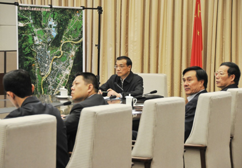 On April 22, Chinese Premier LI Keqiang chairs a meeting to arrange earthquake relief work. The aerial remote sensing image on the wall was produced by RADI.
This was another task undertaken by RADI to conduct remote sensing monitoring on major disasters after the Wenchuan Earthquake in 2008 and Yushu Earthquake in 2010. RADI researchers responded even faster by learning from past experiences. Their timely data acquisition and sharing and comprehensive reports greatly improved disaster rescue capacity, saved a huge amount of resources, and rendered strong support to the operation. Their work was highly spoken of by central authorities.
For instance, Vice Premier LIU Yandong made instruction on an analysis of the road damage in Baoxing County in the earthquake-stricken region. CAS President BAI Chunli said that RADI made rapid efforts to collect and process data and sent timely analyses to the central government. This was a specific example of how science and technology served major issues concerning people’s livelihood.
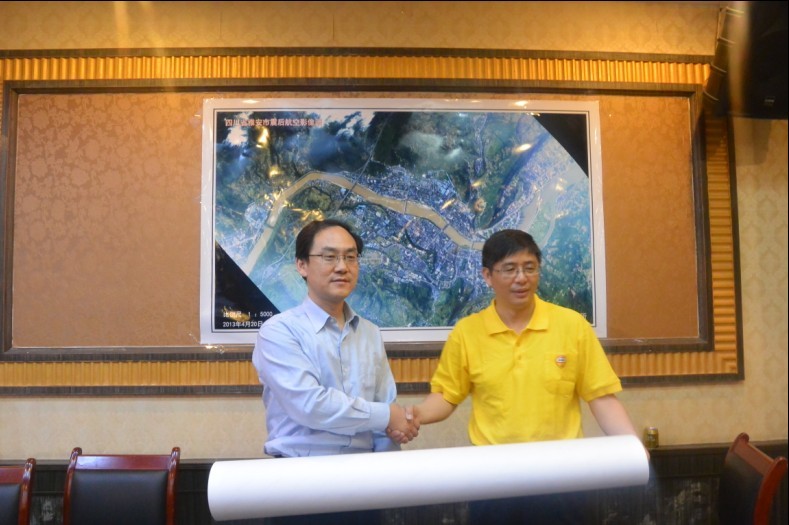 Prof. ZHANG Bing, Vice Director-General of RADI, presents aerial remote sensing images at different scales to the headquarters for emergency management of the China Earthquake Administration.