China's new Gaofen-6 Earth observation satellite has successfully transmitted data and images to ground following its launch over the weekend.
The Institute of Remote Sensing and Digital Earth (RADI) under the Chinese Academy of Sciences (CAS) announced the return of 40 GB of data from Gaofen-6 on Monday, following a six-minute downlink to the Miyun ground station in Beijing.
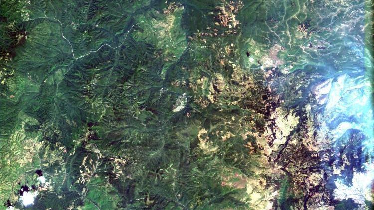
An image captured by the 16m multispectral wide-angle colour camera on the Gaofen-6 Earth observation satellite. CNS/RADI/CAS
Gaofen-6 was launched on Saturday from the Jiuquan Satellite Launch Centre along with the nighttime remote sensing Luojia-1 CubeSat, marking the country's 16th successful space launch of 2018.
The pair were placed into a near 800 km altitude Sun-synchronous orbit, from which the 1,064 kg Gaofen-6 will carry out remote sensing tasks using its 2-metre resolution panchromatic camera, an 8m multi-spectral imager and a 16m multispectral wide-angle colour camera.
The satellite has a designed lifetime of eight years and will observe chlorophyll and other nutritional crop content, and help to estimate yields of crops such as corn, rice, soybeans, cotton and peanuts, Tong Xudong, chief engineer of the Gaofen series satellites, told state media after launch.
China High-resolution Earth Observation System
Gaofen-6 is the latest in a series of China High-resolution Earth Observation System (CHEOS) satellites, consisting of multi-spectrum imaging and synthetic aperture radar satellites.
CHEOS is intended to provide high temporal, spatial and spectral resolution Earth observation for resource and environmental management, disaster prevention and relief, and meteorology, climate, hydrology and global change monitoring.
It will also assist China's Belt and Road initiative (BRI) as well as the Beijing-Tianjin-Hebei collaboration, and could include aeroplanes and stratospheric balloons.
Last month, China launched the Gaofen-5 hyperspectral satellite, which followed a trio of smaller Gaofen-1 imaging satellites orbited in late March.
Next launch
On Tuesday, China is set to launch the Fengyun-2H weather satellite from the Xichang Satellite Launch Centre at around 13:10 UTC (21:10 Beijing time, 09:10 EDT), according to airspace closure notices consistent with the launch profile.
No live streaming or footage is expected of the launch, with confirmation of the mission likely only after it is deemed successful.
China is aiming to launch around 40 times in 2018, including government, international and commercial missions, which would be nearly double the national record of 22 launches set in 2016.
News source:GB Times