Hosted by RADI with Hainan Province Key Laboratory of Earth Observation (LEO) as organizer, a “Maritime Silk Road Spatial Cognition Forum” was held at RADI Sanya Campus on 10 April 2015. The event was attended by nearly 200 experts from relevant ministries, commissions, research institutions, and universities.
Hainan provincial governor LIU Cigui visited Sanya Campus and met with CAS academicians XU Guanhua, QIN Dahe, SU Jilan, AN Zhisheng and GUO Huadong who attended the Forum, and had discussions with them on such issues as scientific innovation, “One Belt & One Road”, maritime disaster prevention & mitigation, etc.
With rapid social and economic development, more and more countries are now confronted with resources shortage and environmental pollution, but remote sensing technology can play an important role in optimizing the allocation of resources, XU Guanhua said. LEO will serve as an “eye” in Hainan’s social and economic development by providing support for scientific planning, eco-system protection, tourism, tropical agriculture, disaster prevention & mitigation, and marine environment monitoring, he added.
GUO Huadong was invited to deliver a report entitled “Space-based Observation and Scientific Cognition of One Belt & One Road”. In his report, Guo displayed some satellite images of the “maritime silk road” and the “silk road economic belt”; introduced China's progress in the space-technology-based study on the “Resources & Environment Status and Development Potential of the Silk Road Economic Belt”; and put forward the idea that space information technology not only can provide preliminary strategic consulting for China in its efforts to make planning for the Silk Road Economic Belt but also may offer spatial and environmental status information to other countries along the silk road. China should use space technologies in the study on “One Belt and One Road” and accelerate Maritime Silk Road development by initiating a regional earth observation program and building a “digital silk road”, a virtual ground station, etc, he suggested.
The experts expressed their views on a series of related issues, including South China Sea and Maritime Silk Road development strategies, the impact of climate change on Maritime Silk Road development, the role of geographical science in this respect, the contributions that earth scientists may make to this area, how remote sensing experts can participate in Maritime Silk Road development, what role can space information can play in this regard, etc.
Located on RADI Sanya Campus, LEO was founded in November 2014 with the support of RADI. Dedicated to the mission of “Where national interests are extended, there is spatial information support”, the laboratory serves Hainan’s international tourism development, the nation’s South China Sea strategy and its 21st-century Maritime Silk Road Strategy.
As a major national strategic layout, the “Silk Road Economic Belt and 21st-century Maritime Silk Road” program was substantially initiated in 2015. With the advantage of macro, rapid and accurate cognition of objects, space-based observation technologies are of important significance in helping the government understand resources distribution and environment pattern from a strategic perspective.
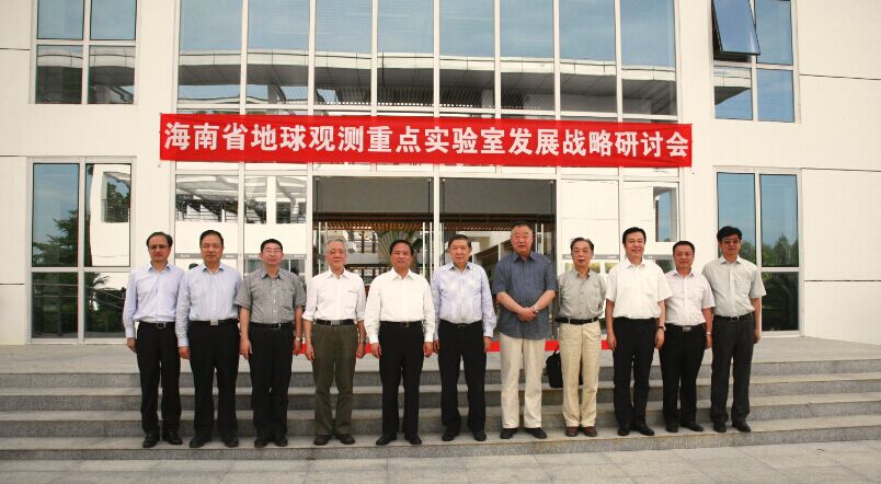
A group photo of Liu Ciqui and the academicians who attend the Forum.
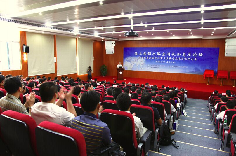
Nearly 200 people attend the Forum.
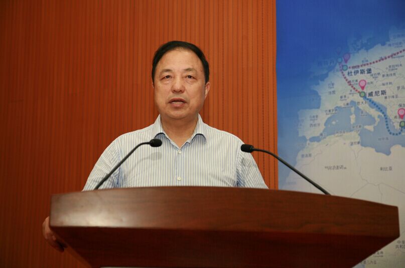
CAS Academician Guo Huadong is invited to deliver a report.
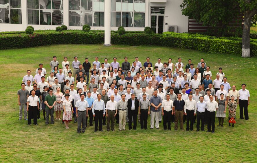
A group photo of all participants.