The serious bushfires burn in the New South Wales (NSW) of Australia on October 17, 2013, which described as “out of control”.
On October 21, 2013, at the request of Geoscience Australia, RADI took prompt actions on disaster relief. Researchers from the CAS Key Laboratory of Digital Earth Sciences and the CAS-TWAS Centre of Excellence on Space Technology for Disaster Mitigation carried out remote sensing monitoring and evaluation on the fires, and made preliminary interpretation and assessment on the fire sites, spreading areas, and developing trends for the surrounding areas of Sydney, based on CCD images received by China’s HJ-1A Satellite. On the morning of October 22, Australian authority received the assessment report from RADI, which is proved to be “very useful”, according to Australian feedback.
RADI will continue monitoring the bushfires, and ready to provide further assistance to Australia if needed.
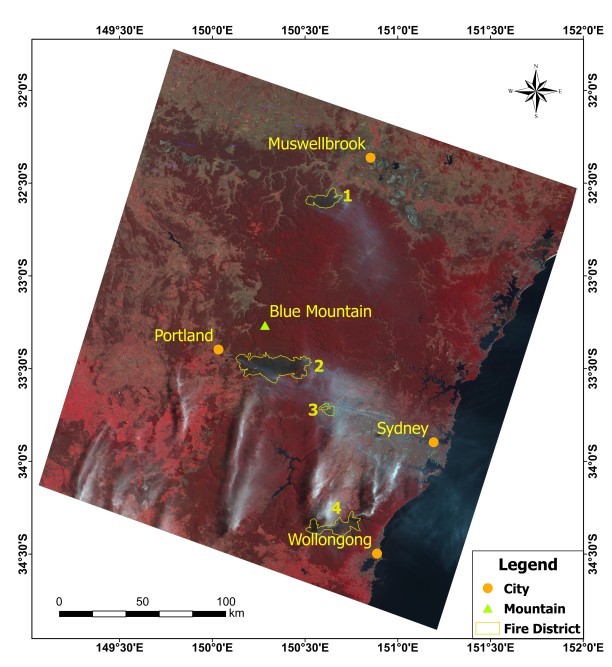
Bushfire monitoring map of the surrounding areas of Sydney (Image by HJ-1A Satellite on October 20, 2013).