When the quake hit Dingxi on July 22, the Institute of Remote Sensing and Digital Earth (RADI) has launched the emergency response plan and made fast evaluation of the hit area and population while looking into the pre-quake historical files and applying for post-quake satellite data. The evaluation results are as follows:
1. The severity of the quake reaches the level of VIII and an area of about 16,340 km2 has been influenced (calculated according to the simulated area hit by a quake of the intensity 6), mainly including Minxian County, Zhangxian County, Lixian County, Dangchang County, Lintan County and Zhuoni County, etc., as showed in the figure below.
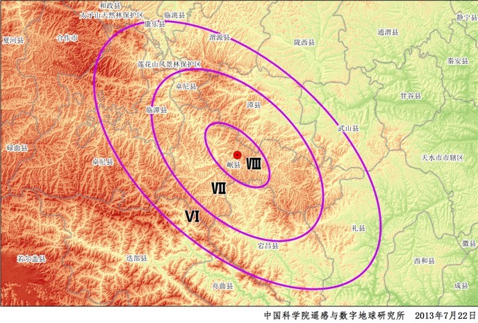
Fast evaluation of the area hit by the earthquake with a magnitude 6.6 in Minxian County and Zhangxian County in Gansu Province
2. In accordance with the data of local population, the number of influenced people in the hit area reaches about 900,000 (calculated according to the simulated area hit by a quake of the intensity of 6), and the distribution of influenced population is shown in the figure below.

Fast evaluation of population influenced by the earthquake with a magnitude 6.6 in Minxian County and Zhangxian County in Gansu Province