
On the afternoon of June 20, Cambodian Deputy Prime Minister Dr. Sok An met in his residence the delegation of the Institute of Remote Sensing and Digital Earth (RADI) of the Chinese Academy of Sciences (CAS) and the International Centre on Space Technologies for Natural and Cultural Heritage (HIST) under the auspices of UNESCO. The delegation was in Cambodia to attend the 37th Session of UNESCO World Heritage Committee and to make a study tour to Angkor, the cultural world heritage site.
Sok An highly praised the substantial cooperation carried out by HIST and RADI with the Authority for the Protection and Management of Angkor and the Region of Siem Reap (APSARA) and promised full support to such cooperation. According to Sok An, After the inclusion of Angkor into the World Heritage List in 1992, more than 20 countries have participated in its restoration and reconstruction under the advocacy and coordination of UNESCO, making contributions to the protection and maintenance of the site. However, continuous social and economic development posed huge challenges to the conservation of the surrounding ecological environment of Angkor Site including illegal housing in its vicinity, deforestation in the north, etc. These all leave the Angkor Wat under severe threats. The dropping ground water table in the dry season and the floods in the rainy season may both undermine it. Therefore, the Deputy Prime Minister hoped that on the basis of the Memorandum of Understanding for Cooperation between the two sides, HIST and RADI would offer technological support so that APSARA can use space-borne and air-borne remote sensing technology to monitor the surroundings of Angkor. He also hoped that RADI can send its remote sensing aircrafts to Siem Reap to collect data on Angkor Site, Kulen Mountain in the north, watersheds of Siem Reap River and two other rivers flowing down from the north, and Tonlé Sap Lake in the south, so as to provide basis for the policy-making concerning the protection and management of the world heritage site of Angkor as well as to strengthen the preservation of the ecological environment surrounding the site. Meanwhile, He also expressed the hope that HIST and RADI could train professionals in space technology for APSARA and set up an office in the city of Siem Reap, for which the Cambodian side would like to offer a villa. At last, he suggested that HIST start the remote sensing project as soon as possible and present its research achievements at the Third Intergovernmental Conference on the Conservation and Development for Angkor Wat Archaeological Site to be held in Siem Reap at the end of the year under the auspices of UNESCO, so as to showcase the technological advantages of HIST and RADI.
Academician Guo Huadong, Director-General of RADI and Director of HIST, gave a brief introduction to HIST and RADI. He said that HIST would launch the environment remote sensing project for the Angkor heritage site as soon as possible with the support of the Chinese government and Chinese Academy of Sciences, under the framework of the MoU and on the basis of the discussions between the two sides.
At the invitation of the UNESCO World Heritage Center and APSARA, Guo and his parties attended the 37th Session of the UNESCO World Heritage Committee held in Phnom Penh to discuss the cooperation on using space technologies for the conservation of Angkor Site and to do a field study in the Site as well as its surroundings. On June 14, on behalf of HIST, Guo Huadong signed the Memorandum of Understanding for Cooperation with Mr. Bun Narith, Director-General of APSARA in the Council of Ministers, Cambodia. After that, Prof. Guo and his team had a work meeting with APSARA Authorities in the National Commission of Cambodia for UNESCO on the content, ways and other aspects of the cooperation under the framework of the MoU. He also paid an investigation visit to the Kulen Mountain, the Tonlé Sap Lake and Siem Reap which surround of Angkor Site.
HIST is the first international center on using space technologies for world heritage sites under the auspices of UNESCO and the first UNESCO research center of CAS. Relying on the development of the Institute of Remote Sensing and Digital Earth (RADI), HIST aims to use RADI’s advantageous space technologies to support UNESCO and its members in conserving and managing world heritage sites, building their capacity and promoting sustainable development.
Located in northwestern Cambodia, Angkor is renowned for its grand architecture and fine relief sculpture, and it is also the largest temple in the world. It was listed by UNESCO as a world cultural heritage site in 1992. The Cambodian government has made it a national strategy to protect Angkor well. In the past nearly two decades, with the mediation of UNESCO, over 20 countries have assisted the Cambodian government in the restoration and reconstruction of Angkor. However, as the number of tourists grows and the social and economic development progresses in Cambodia, the surroundings of Angkor, which are vital to its survival, are facing serious challenges such as deforestation, disorderly immigration and illegal construction. Potential risks have also been detected in river basin conditions and ground water situation. Space technologies are urgently needed for monitoring purposes, while Cambodia is in lack of conditions and talents in this area. Therefore, the Cambodian government and APSARA both wished to cooperate with HIST.
Deputy Prime Minister Sok An shakes hands with RADI Director Guo Huadong.
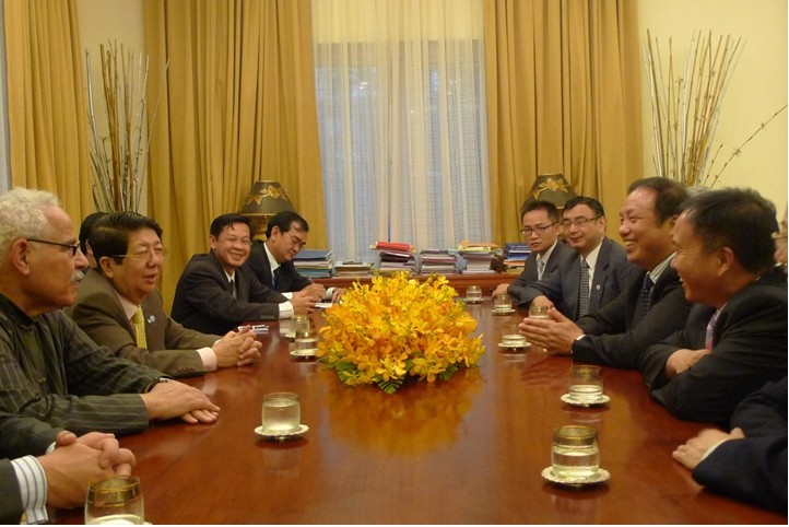
Dr. Sok An meets with RADI and HIST delegation.

Guo Huadong, on behalf of HIST, signs the Memorandum of Understanding for Cooperation with Mr. Bun Narith, Director-General of APSARA.
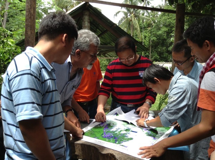
The delegation’s field trip to Kulen Mountain.