A RADI delegation, led by ZHAO Qianjun, Deputy Director of RADI, paid a visit to Space Krenovation Park of Geo-Informatics and Space Technology Development Agency (GISTDA) and its headquarters, Royal Irrigation Department, National Disaster Warning Center, National Wildlife And Environmental Protection Department for exchanges based on the implementation progress of the project of "Application of China-Thailand satellite data in flood disaster management over regions with frequent flood in Thailand" at the invitation of Anond Snidvongs, Director of GISTDA from September 20 to 25. The delegation visited Space Krenovation Park of GISTDA in Chonburi, and listened to the staff's description of the park construction and the data receiving and processing system for international satellites and Thailand Earth Observation Satellite (THEOS). The project team members learned that the satellite ground receiving station built in Space Krenovation Park 35 years ago could not only receive the data from the American LANDSAT series satellites, French SPOT series satellites and THEOS, but also receive the SAR satellite data of the X band, directly preprocess such data, generate the Level-2 data products and supply them to users. At present, GISTDA is constructing Space Technology Museum in the park which will be opened to the public.
The project team members had a discussion with the members of the Thai project team led by Surachai, Deputy Director of GISTDA. The Thai delegation mainly gave an introduction to GISTDA's applications in such fields as agriculture, disaster, natural resource monitoring and city planning in Thailand, while the Chinese side gave a brief introduction to the progress of the China-Thailand project, as well as Institute of Remote Sensing and Digital Earth of CAS, State Key Laboratory of Remote Sensing Science and Remote Sensing Laboratory for Environmental Health. After that, the two sides had further discussions about how to improve satellite data sharing between the two sides through such cooperative research as remote sensing diagnosis of environmental health, and about establishing joint research centers and proposing that the outstanding young scholars in Thailand apply for the scholarship offered by the Chinese government.
During their stay in Thailand, the members of the project team visited Royal Irrigation Department and National Disaster Warning Center of Thailand respectively in response to "flood disaster prediction" and "flood disaster warning" which are the major missions of the China-Thailand cooperation project. They heard the presentation by the staff of Royal Irrigation Department about hydrologic monitoring, etc., visited Real-time Weather Monitoring Room, Real-time Flood Monitoring Room and other rooms, viewed and learned from the hydrologic monitoring work on the spot, watched the entire simulated process of disaster warning performed by Disaster Warning Center, including data collection, disaster level identification and monitoring, warning and notification, and learned about the methods taken by the center in data collection, prediction, warning and timely response against the major disasters in Thailand. In addition, they visited National Wildlife and Environmental Protection Department of Thailand, and learned about how the department uses the GIS technology combined with field investigation and other methods in the soil conservation, flood prevention, disaster alleviation, forest conservation, etc. in the mountainous areas in Thailand.
Both parties of the China-Thailand project have, through the 6-day visits and exchanges, deepened their understanding about each other, and reached a consensus on further cooperation in the research. In 2014, the project of "Application of China-Thailand satellite data in flood disaster management over regions with frequent flood in Thailand" will continue to expand the application of the remote sensing data of both China and Thailand, and complete the research on such application in the management over the regions with frequent flood in Thailand under the framework of the long-term cooperation as determined by "The Twentieth Session of China-Thailand Joint Committee on Science and Technology Cooperation".

The Delegation visited Royal Irrigation Department.
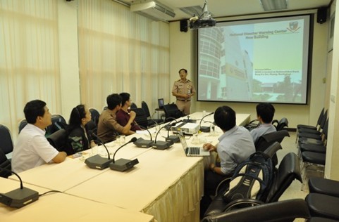
The Delegation visited National Disaster Warning Center.